Detail Berita
Unveiling the Landslide Potential in North Balikpapan: A Crucial Study for Disaster Mitigation
Isi Artikel
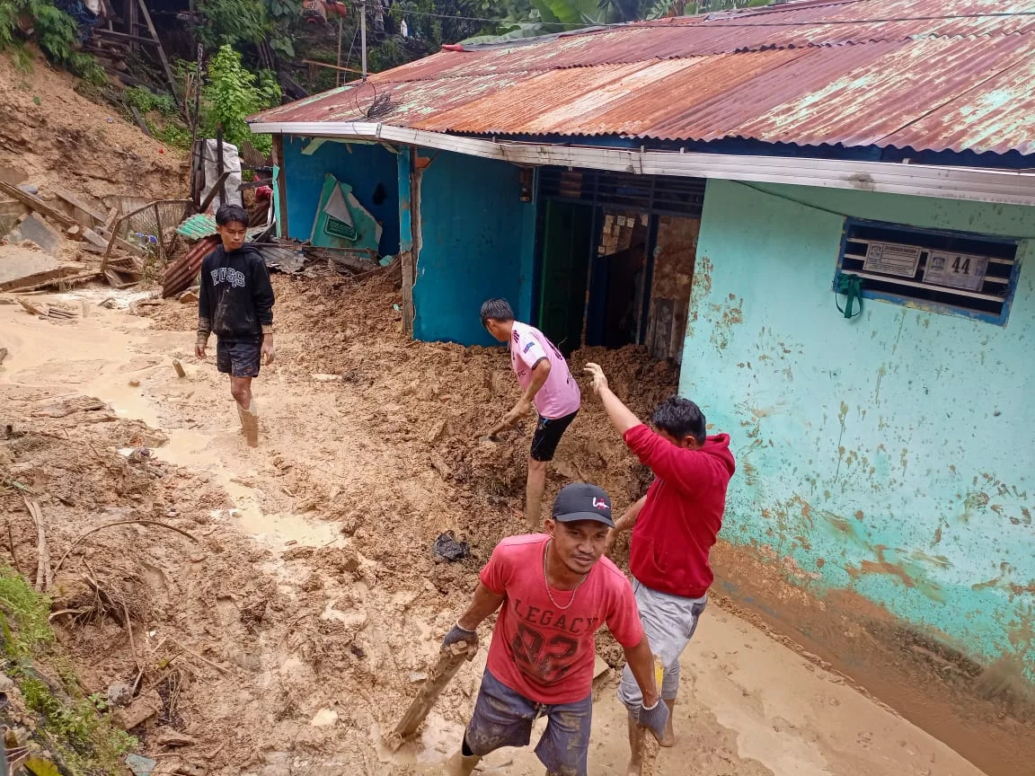
North Balikpapan, a rapidly developing district, faces a serious threat in the form of increasingly frequent landslides each year. This phenomenon has become a major concern due to its significant impact on the safety of residents and local infrastructure. Andi Aschar, a student from the Urban and Regional Planning program, conducted a study to identify landslide-prone areas in North Balikpapan and to understand the physical factors that contribute to these occurrences.
The study revealed that slope gradient is the most dominant factor triggering landslides, with a weight of influence of 44.6%. Other influential factors include land cover, which contributes 28.1%, followed by soil type, rainfall, and geological conditions. In his research, Andi Aschar applied overlay analysis methods to map areas with varying levels of vulnerability. The results indicated that the moderate vulnerability class dominates the developed areas, which necessitates more attention in future regional planning.
The study also involved a hotspot analysis to identify locations frequently affected by landslides. When these results were compared with the generated vulnerability model, a correlation of 52.6% was found, indicating a moderate relationship between the model and actual landslide events. This suggests that the model is sufficiently accurate to be used as a guide in disaster mitigation and planning.
The findings of this study provide important insights for policymakers and the community. Understanding that slope gradient and land cover are the main factors influencing landslides allows mitigation efforts to focus on better land management, such as reforestation in vulnerable areas and controlling development in steep regions.
Andi Aschar's research serves as a strong foundation for better planning in North Balikpapan. However, this is only the first step. Further research is needed to examine other factors and dynamic variables that may influence landslide vulnerability, such as climate change and human activities.
With a deeper understanding, it is hoped that mitigation efforts can be carried out more effectively, minimizing risks and ensuring the safety of the community and the sustainability of infrastructure in North Balikpapan. For residents, awareness of potential hazards and preventive actions is also key to facing the threat of landslides in the future.
Isi Artikel
Berita Terpopuler
Research and Community Service

Research and Community Service
Tags
Student Research Research Balikpapan DisasterTags
Student Research Research Balikpapan DisasterBerita Terpopuler
Research and Community Service
Research and Community Service
Berita Terbaru
 Diktisaintek Berdampak
Impact Trail: Learning Through Service and Growing with the Community at Pasar Bangun Reksa
Dari Pasar Bangun Reksa, Mahasiswa ITK Menemukan Makna Pengabdian
 Announcement
PGTC 2026 Offers National Competitions and International Opportunities
 Achievement
Mahameru Band ITK Secures Second Place at the 2026 Kodam Band Festival